As per usual, I have completed a course. As per usual, I believe that my final exam was 85% desperate floundering and 15% filling out simple definitions while feeling smug. In this case, it was on aboriginal cultures of North America. So a little depressing, but interesting. Also as per usual, I will generously share my misconceptions and useless notes that did me so much good a few days ago. Quite a lot of these will be from things I haven’t known of or cared about for over four months, so there’s an added fact-filter there too.
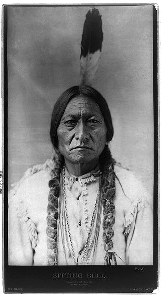
You have failed to impress Sitting Bull in the slightest.
First off, let me tell you about culture areas. Culture areas are what you get when you take a map and divide it into big lumps, then stand back, squint, and say “I guess the guys in there sort of live similarly kind of really.”
Okay, not really. Culture areas are based around a few ideas that work together. First off, in an environment, people will probably use the stuff in it. Second, they’ll probably use it in a way that’s useful. Third, if they find out someone else is doing something neat (“GRINDING the acorns for flour, as opposed to stuffing them in your ears, you say?….”), they’ll probably try it out themselves. The upshot of this is that groups living in the same broad vicinity of each other, within the same environment, will likely exploit the same resources and share certain methods of doing so through diffusion. That’s the concept of culture areas, really – you live in sort of the same place as some other people, you’ll all probably have broad similarities. Naturally, this isn’t as easy as it looks, don’t try this at home kids, etcetera, etcetera, excrement.
Now that we’re all up to speed and sped up, here’s a vague overview of the culture areas within North America. Probably.
The Arctic
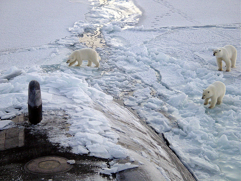
These bears can't imagine why someone would need so much metal to go swimming in subzero water.
The place: The Arctic is a fun place to live. There’s not much to eat, so if you CAN eat something you’d damned well better. A lot of it’s going to be meat – there’s a reason the polar bear is the only real pure carnivore of its family, you know. Plant life on the tundra packs everything it’s got into a neurotic and paranoid summer of buoyant growth before dropping into a pathetic coma afterwards.
The people: You can lop the Arctic’s inhabitants into three big crude groups: Aleuts (who lived in…well, the Aleutian Islands, and part of the Alaskan Peninsula), Yup’ik (south-southwest Alaska and the Asian shore of the Bering Strait), and Inuit (the entire top of North America, the Arctic Archipelago, and Greenland’s coasts). The Aleutians and Pacific Yu’pik liked a lot of seafood – and they had a lot of seafood, enough to get some complex society going, with chiefs and slaves and commoners and everything! – and the inland Yu’pik and Inuit less so, with more caribou and such in their diets.
How they’re/have been screwed: Global warming and the Arctic are playing happy funtime pals, and there’s oil in them thar hills.
The Subarctic
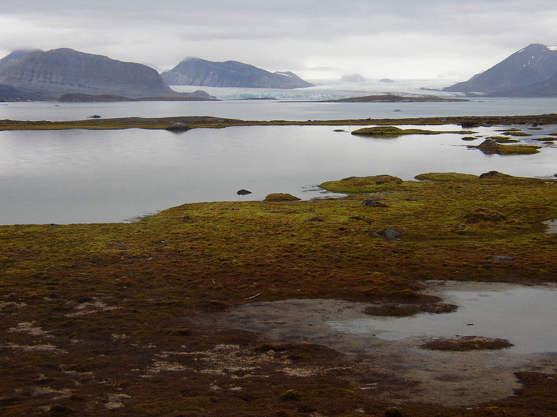
Too pretty to be funny.
The place: Strictly speaking, what you’re in if you walk south of the little dotted line that says “Arctic” on it. The Subarctic covers a lot of Canada, with forests being more and more evergreeny the farther north you go (near the top, lots of spruce). Usually there isn’t a lot of rain or other precipitation. The eastern Subarctic is heavily defined by the Canadian Shield (the hugeass rock base that surrounds Hudson’s Bay on all sides), and has all sorts of bogs, swamps, lakes, and rivers, speckled with fur-bearing animals, fish, moose, caribou, and all sorts of other stuff (like blueberries – everybody loves blueberries). The western side of the Subarctic in Canada wanders a bit north of the treeline into tundra territory, with lots of lich and nary a tree to be found. Caribou are all over the place, making their meat a must over here, spiced up with fish and migrating birds and whatever else you can find. Which includes musk ox. Everybody loves musk oxen!
The people: From here on we’re running on examples of one or two cultures per area. In this case, the eastern Subarctic has the Cree, the western the Chipewyan/Dene (“Chipewyan” being a Cree word for “pointed skins,” which apparently refers to the dangling points on poncho-like thingies the men wore), who lived spread thinly across tundra eating lots of caribou and a good deal of fish. There are quite a lot of Cree – their geographic territory has actually increased since contact, and they’re one of the largest First Nations groups in North America – but they’ve rubbed elbows with Europeans for so long that figuring out their precontact lifestyles and beliefs in any sort of great detail is like searching for semidigested food in Gandhi’s gullet. The Chipewyan were and are a lot less numerous, and it took quite some time for any Europeans to run into them – none of whom managed to get back really reliable input. After a while they migrated into trapping as a business, some of them went a bit farther south, and they absorbed a rag-bag of miscellaneous concepts, beliefs, and attitudes – notably from the Cree.
How they’re/have been screwed: The James Bay Cree in particular are stuck in an off-again-on-again-off-a-hahahahaha-no-it’s-on-again dispute with the federal government and Quebec over why exactly they would prefer not having giant honking hydroelectric dams built near them, which they’ve kept on top of (which may sort of kind of not really have been possibly worked out..to a degree). The Chipewyan are spared such issues, because they already went through the whole decimated-by-disease-and-forced-schooling-of-children-far-away-from-their-parents things (in the 1800s and 1935+ respectively) and have decided they’re through with it.
California
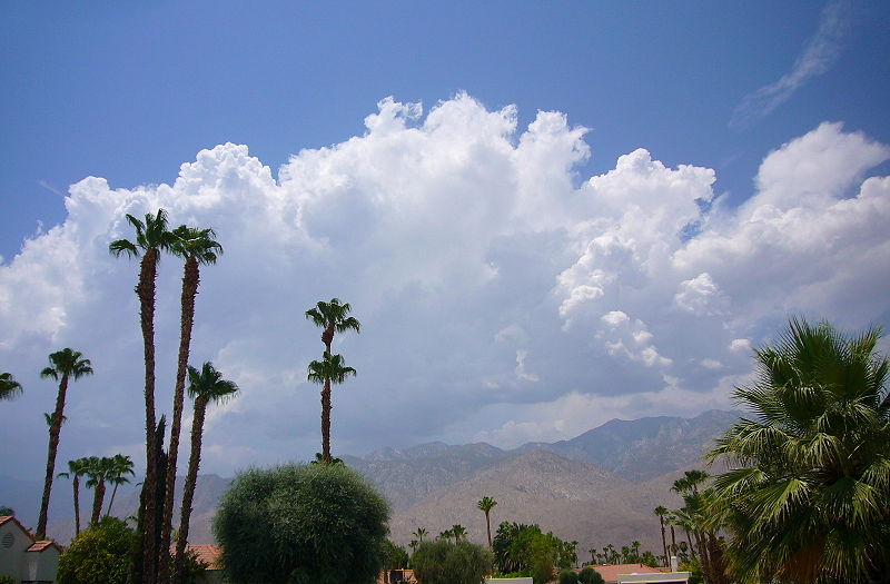
Once upon a time, this was in no way associated with Hollywood.
The place: California’s geography is all over the place – high, low, desert, forest, barren, fertile. Depending on where you’re living you’re grinding mesquite beans into nutritious mush, gathering acorns to make a deliciously gritty flour, fishing for salmon, or maybe hunting sea lions. Surfing, however, simply was not done.
The people: The California culture area is pretty varied, so the Cahuilla end up as the standard example simply by dint of having more information about them than anyone else. Such as about the vast, fresh harvest of money the Palm Springs Cahuilla reap every day from thousands of suckers entering their casinos. There’s three rough population divisions of Cahuilla – desert (Palm Springs), mountain, and pass. The desert Cahuilla own billions of dollars worth of land, two casinos, a spa hotel, and whatever other stuff they feel like.
How they’re/have been screwed: Exactly the way you’d expect any minority group owning a lot of money to be. Technically they’re tax-exempt, but there’s an awful lot of pressure to give more and more cuts to the state and such. There’s also the fun situation of being a major gambling player in a state that sends around $9 billion worth of business to Las Vegas every year. They aren’t friendly competitors.
The Great Basin
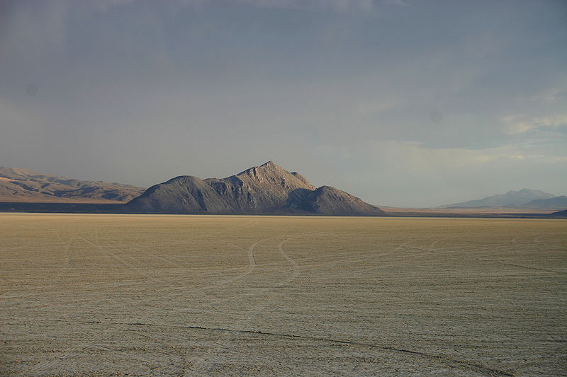
Not quite Mars, but the next best thing.
The place: The Great Basin is named for a fun little feature of its geography: not a single one of its waterways flows into the sea. Instead, it’s pretty much evaporation or nothing. Alas, the culture area of the Great Basin extends slightly outside the basin itself, which takes up a big chunk of the American West including most of Nevada, lots of Utah, and bits and pieces of Mexico, California, Wyoming, Idaho, and Oregon. It’s not all hot sagebrush and steppe though – just nearly all. The higher the land, the more precipitation and coolness it gets, and there’s some highland trees that make a decent living partway up the mountain ranges, to say nothing of the flora you’ll get along the waterways.
The people: Our item today is the Western Shoshone, who were one of those peoples that weren’t let in on the whole “Hello, melanin-deprived individuals are taking over your stuff” thing until a bit of the way into the 1800s – around 1828-1829, to be precise, when the Ogden party came along the Humboldt River to do some trapping. They said they were a bunch of poor, wretched jerks that had to eat roots or starve to death, then their livestock ate some of their edible foods and they left. When the next bunch of trappers arrived, the Shoshone were somewhat annoyed, and told them to give them food and horses or else. The trappers politely disagreed by killing some of them, and relations didn’t exactly go anywhere mellow from then on.
To be fair, the Shoshone DID eat roots..and seeds, and hares, and rabbits, and antelope, and nuts, and just about anything else that was around, from migratory birds to bighorn sheep. They were very flexible.
How they’re/have been screwed: The Ogden party was really the best indicator of things to come the Western Shoshone could’ve recieved. Miners and settlers passed through to California and Oregon, using up resouces along the way, and both they and the Shoshone had their hands full quietly murdering each other out of resentment. Salt Lake City sprung up, and ranchers and farmers started taking up good food and water. The 1862 Homestead Act sent more and more people after land, and a lot of it was Western Shoshone land. Shoshone collecting silver at Battle Mountain for crafts were displaced without compensation in 1862 up until the early 2000s – during which time the miners at the silver deposits were piping in lots of local water, using vast amounts of charcoal, and heaving around heavy equipment. A reserve at Ruby Valley was made, was crappy, and was abandoned, and the solution was apparently to build a fort (Fort Ruby, naturally) and systematically kill Shoshone to make them calm down a little. The Treaty of Ruby Valley eventually gave the Western Shoshone some sort of half-assed right to their own land and some supplies every year that often were stolen or stolen and sold back to them, in exchange for agreeing not to molest any settlers, which they grudgingly abided by.
On the bright side, smallpox wasn’t as nasty as it could’ve been. Its 1860 arrival was blunted by the Western Shoshone living mostly in small, disparate groups, and a quick federal vaccination program.
The Plateau
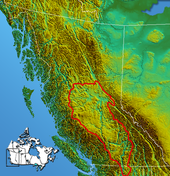
Yep, that's a plateau all right.
The place: The Plateau itself consists of the Interior Plateau of British Columbia – the continuation of said plateau into the states is the Columbia Plateau. Plateau, plateau, plateau – yes, by now I believe it’s lost all meaning in my head.
The Plateau is a diverse, higgledy-piggledy environment, with a continental climate and vegetation gradiating from forested Upper Columbia to mixed coniferous Fraser River grasslands and down to sagebrush steppe in Middle Columbia. The main connecting features between its many peoples, tangled up as they are in its diverse environment, are as follows:
- They had semi-permanent winter or summer villages.
- Kinship groups within each band maintained stewardship over resources.
- They liked salmon a whole bunch like you wouldn’t even believe.
3 there corresponded nicely with Columbia and its river systems (the Fraser and the Columbia), so for the most part that worked out.
The people: The plateau’s peoples, as said above, were nicely diverse. In Upper Columbia you had the Northern Okanagan and the Ktunaxa/Kootenai; in the Fraser River area the Salishan, and Middle Columbia had the Sahaptians and some Salishan outliers. Most of them weren’t living in enormous groups – a chieftain would lead a large village, or a few connected small ones. Beyond the salmon, plant harvesting was a biggie – and the acquisition of them was half-gathering, half-horticulture – such as yellow avalanche lilies, which were harvested before having their bulbs and tips replanted, often in good soil where they wouldn’t be able to find their way naturally, or at least with any ease.
How they’re/have been screwed: Well, the BC gold rushes of the 1850s-1860s didn’t exactly do ANYONE any good, but it was especially hard on the St’at’imx, Secwepemc, and Okanagan. The smallpox epidemic of ’62 wasn’t a helpful followup, and by the time the gold rushers finally left in the 1870s settlers had followed along. By the 1880s the locals had been turfed out of most of the most fertile land.
The Kootenai of Bonners Ferry, Idaho, as a small example, were encouraged to relocate from their prime, luscious valley bottom land to the Flathead Reservation of Montana. Those who weren’t quite gullible enough to leave were grudginly allocated their land by 1887, which was divided into tiny little allotments that they were told to farm, ignoring the issue of it being too small for farming or their more traditional gathering practices. By the time a few generations of inheritance had passed by, the allotments were tiny beyond belief and mostly leased to farmers in what were occasionally bills of sale.
The Plains
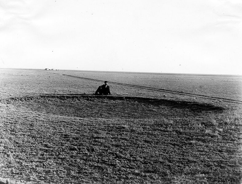
Back in MY day, we HAD to walk through the tall grass. And beat off the 'raptors with HALF a stick.
The place: The plains that are permanently known as “great,” these formerly-grassed stretches of absolute Flat occupy a nice core of North America, from Texas to Alberta. You can also call them “prairies” because that is much more stylish and Canadian*. Whatever. They consist of lots and lots of rolling grasslands, or did, before we wandered in and replaced an awful lot of it with crops. To do this we had to evict an awful lot of people.
The people: A grossly abbreviated list of peoples that at one time or another have been on the prairies would include the Crow, Blackfoot, Bungi, Assiniboine, eventually the Plains Cree, the Comanche, and about seven zillion others, give or take a few. Some roamed around the shortgrass plains (sometimes with dogs to haul stuff), some farmed along the eastern edges.
How they’re/have been screwed: Well, there’s the obvious issue of loads of them rather enjoying bison, leading to the whole attempted extinction of them and such, but there’s a bit more. Interestingly, part of the issue was horses. The shortgrass nomads took to them like ducks to water, and it’s interesting to note that the word for horse in many plains languages means something along the lines of “big/great/better/AWESOMETASTIC dog.” A horse was like a dog, but better in every conceivable way – it hauled more, could carry you, made travelling miles a breeze, and hunting bison was a chore no more. The less nomadic villagers agreed, used it to hunt buffalo, and were promptly beaten to a pulp whenever they tried that shit by nomads, who weren’t tied down to stupidly vulnerable houses and crops and didn’t appreciate the competition.
So, the nomads got nice toys at least? Wrong. The farther north you got, the more likely your horses wouldn’t make it through the winter. The Blackfoot in particular got it hard – only the southernmost branch of them, the Piegans, got anything near parity, and they did it with help from living in the warm-wind’d chinook belt by the Eastern Rockies. The Crow were similarly advantaged, living in a cold, northern area near the Rockies that nevertheless had the Windy River Basin and some woody riversides for overwintering. Everyone else near them (like the Blackfoot and Gros Ventres) just had to deal with replacing horses constantly, and tended to take it out on them. In general, horses were so valuable that raiding for them was common and war became common as hell – not only did those other dicks have horses YOU should have, but they were taking up grazing ground YOU should use! Oh, and the Crow had to get guns to fight back, got guns with a free microbe bonus, died in droves, and then were nearly obliterated when the Lakotas moved into town. Their existance from then on largely depending on clinging very closely to other people – Gros Ventres, Assiniboine, and Americans.
Well, it was better for the southerly tribes…right? Alas, no. They could get loads of horses – the Comanche were veritable horse emperors for a time – but they competed fiercely for grazing ground with the very buffalo that, thanks to the horses, was being overhunted. To throw another wrench into the bargain, the previously eglatarian societies had realized that everyone being equal worked only when everyone was poor, and now they had tons of horses. Societal stratification went from zero to through the roof.
Pretty much the only people that got pure mileage out of the horses was the Lakota Sioux, and that was because they had the lousy luck to live in an unusually chilly spot with a shitty growing season. This kept their herds on the small side – not stunted, but small – and prevented any buffalo-based collateral damage. At least until the US army stepped in, and well, past that I think we know what happened.
(*Canadians are always stylish)
The Northeast
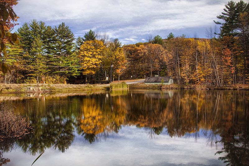
The gorgeous telephone poles of the New England autumn.
The place: Or the Eastern Woodlands, if you would be so kind. Lakes, rivers, richly mixed coniferous AND deciduous forests, teaming with game, fruits, nuts, roots, and even wild rice. Good growin’ foods include maize, beans, and squash. Fish and all other manner of life aquatic were eminently devourable.
The people: Two ultra-broad groups for the most part: Algonquian-speakers and Iroquoian-speakers. The Iroquoian-speakers farmed a little more, and the Algonquian-speakers hunted, fished, and gathered a little more, although they both dabbled in one another’s specialities quite heavily. Groups included the Mi’kmaq (who were highly maritime-based hunter/gatherers – much more productive than land-based gathering), Huron/Wendat (Iroquoian-speaking horticulturists), and the groups of the Iroquoian Confederacy – the Mohawk, Oneida, Onondaga, Cayuga, Seneca, and Tuscarora, which formed the Six Nations (ditto). Technically, the Huron/Wendat were a similar assemblage, and this kind of confederacy of tribes was sort of a thing in the area in general.
How they’re/have been screwed: The entire Northeast coast was pretty much ground zero for most of North America’s colonialism, or at least some of the fiercest bickering over it. The Iroquois played a game of balance-the-powers for a long time, between British, French, and American, and although they were damned careful at it, sooner or later there were always gaps in the warfare, and whenever the European powers weren’t beating each other up they were perfectly happy to start sniping at them. The Huron allied themselves a little too closely to the French, and were sufficiently weakened by smallpox from their good missionary friends that in 1648-1649 winter attacks from the British-backed Iroquois absolutely destroyed all of Huronia as a nation and united people. The Mi’kmaq also fell in with the French, were encouraged to strike out against the British, and in return recieved systematic genocide and some accidental bacterial fallout from their own allies (deja vu). Peace agreements made at Halifax in the mid-1700s weren’t long-lasting or nearly enough, and the bounties on their heads thinned them down farther still. Food and land pressure became unbearable post-1775.
The Northwest Coast
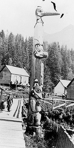
The Northwest Coast's primary artform consisted of beautifully hand-carved inadvertant stereotypes.
The place: The temperate rainforests of the Pacific coast stretch from the northish edge of California into south Alaska, and they’re filled to the brim with salmon spawning routes and more shoals, schools, and beaches of marine food than you could toss a net over and devour messily. Add in the gratuitous quantities of red and yellow cedar prime for the chopping and shaping into, well, practically ANTHING, and you’ve got yourself a pretty serious spot to settle down and make some excellence. Which many people did.
The people: The first Northwest Coasters were probably among the very first people to wander into North America. The easiest route past the glaciers that were busy throttling most of Canada (uncovering the Canadian shield from underneath all that troublesome soil in the process) was the coast, which was relatively ice-free. The common languages of the area show some signs of age too. The Haida, the Tlingit, the Tsimshian… all of them shared a lot in common, most notably a desire to get their hands on as much salmon as humanly possible. Salmon was THE food, salmon oil THE condiment and preservative, and getting ahold of as much as possible every run was SERIOUS BUSINESS. No matter how much salmon might flow, there was something like a 1,000% peak variation in salmon frequency over the four-year cycle they followed, and you can’t really risk under-fishing when you’re all clumped together using up tons of food and the winters are harsh. Plus, if you lived in the interior, you were getting oil-poor salmon that had tuckered themselves out getting all the way inland, so you had an extra handicap.
The Northwest Coast societies had quite a lot, and like all societies where people have a lot, some people ended up with QUITE a lot and others merely a lot. Ranking was based on household positioning, clan segment, and clan, aided by personal merit. There weren’t exactly classes, just lots and lots of ranks (bar slaves, but, as is the case with slaves, no one especially cared about that).
How they’re/have been screwed: Once salmons canneries opened up on the coast (and my goodness, there were a LOT of them opening up on the coast), someone noticed that there were these uppity savages out there taking all the salmon by gumdrops and gumption we can’t have that. Throw in abrupt efforts at controlling fisheries, reservations out of nowhere, gold mining pouring from every orifice, and in the US’s case a serious overdose of rapid “MANIFEST DESTIIIIIIIIINYYYY!” and you’ve got nothing but acres and acres of troublesomeness.
The Southeast
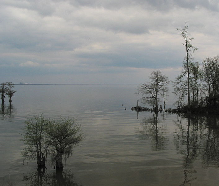
There is no way to say anything about the South that is both funny and nonoffensive.
The place: The Southeast is pretty much where you’d think it’d be, and the environment likewise. Some hunting, some fishing, some farming beans, squash, and gourds.
The people: The Cherokee, Choctaw, Creek Confederacy, and Chickasaw are jointly referred to as the “Five Civilized Tribes.” The Cherokee, who covered the most land, certainly met any standards being thrown at them – they reacted to the strange things being thrown at them (“Wait, you think every one of our villages is responsible for what the others do? OKAY GUYS, TIME TO CENTRALIZE GOVERNMENT!”) with flexible adaptation. They already had political parties (the reds and whites – the former expected to be war-happy young idiots, the later older and mellower) of sorts, and they organized a sort of centralized priest-state during the 1700s. Along the way they ran into slavery, decided it bore some similarity to the way they treated war captives, and adopted it, carefully learning from escaped Cherokee slaves the best methods to squeeze the most labour out of theirs – the men became skilled slave catchers. In 1827 they founded the Cherokee Nation, with a government modelled after that of the US. A man named Sequoya/George Gist had invented an entire syllabary a few years earlier in 1821, and it was adopted as the nation’s written language – within no time at all, almost everyone was literte.
How they’re/have been screwed: Unfortunately, the Cherokee still lacked the most important facet of civilization, which was being white people, and so in 1829 most of the Cherokee Nation was made into state holdings by Georgia. In 1838 soldiers shoved whatever leftover Cherokee they could find in stockades and shipped them out to Oklahoma, or “Indian Territory.” 4,000 out of 15,000 died in the Trail of Tears. The Qualla Indian Boundary, land purchased for them in North Carolina by allies (they couldn’t buy it themselves; I’ll let you guess why), was pretty much their last eastern holdout.
The Southwest
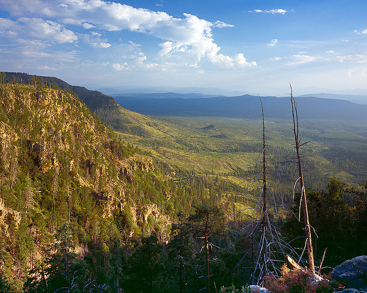
If you want a more classic picture, go watch a Roadrunner cartoon or something.
The place: The Southwest is made up of bits of Utah, California, Colorado, and Texas, along with almost all of New Mexico and Arizona. As you might guess, it’s a little hot. And dry. And rocky.
The people: Groups include the Navajo/Navaho and the Pueblo peoples, which themselves include the Eastern Pueblos (Isleta, Zia, and Taos among them) and the Western Pueblos (including the Acoma, Hopi, and the Zuni).
The Hopi didn’t move around much; their villages were small, but very stable. To the point of insanity – Oraibi/Old Oraibi, their central village, has been settled for something like over a thousand years continuously, which makes it among the record-holders if not the record-holder of North America. They farmed all sorts of plants (various beans, gourds, and sunflowers, maize, squash, and others), looked after wild species, and really liked the hell out of maize, because it was either that or eat about one third as much as everyone else.
The Navaho, by contrast, only appeared as a distinct people until somewhere around 1725. They’re numerous, highly well-known in general, and resilient – which, given where they chose to take up subsistence, seems a necessary qualification. They’re well known for their blankets and silverworking, the former of which they help along by owning lots and lots of sheep,
How they’re/have been screwed: The Navaho EARNED that label of “resilient.” They were pestered by slavers for ages, and when the US got ahold of New Mexico it also inherited a lot of angry Navaho, which it utterly failed to placate. Fort-building followed, and around 1863 they gathered up 9,000 or so Navaho and herded them 300 miles to Bosque Redondo, a distant fort. Approximately 2,000 died on the Long Walk itself or at the fort, and an equal number evaded capture – quite a few of which were nabbed by slavers. Then the livestock reduction policies of the 1940s cut down harshly on their sheep herds to prevent erosion, jobs went flying everywhere, the herding economy went belly-up, and in general things sucked.
The Hopi had fun under the thumb of the Spanish from about 1540 to 1680, when they joined in the Pueblo Revolt and then ran for it. After that they lay low, about eight hundred at their lowest ebb near 1755, many surviving only by living with the Zuni. Navaho land disputes, erosion, and lots of smallpox followed the removal of the Spanish and the arrival of the Anglos in the mid-1800s. Oh, and from 1964 onwards strip mining on Hopi and Navaho land for coal has been in the sort of swing best described as “full.”
Picture Credits
- Sitting Bull: Public domain image from Wikipedia, 1885, D. F. Barry.
- Bears on a sub: Public domain image from Wikipedia, taken by US Navy Chief Yeoman Alphonso Braggs, October 2003.
- Tundra: Public domain image from Wikipedia, Kongsfjorden from Blomstrandhalvøya, Kongsfjorden, Spitsbergen (Svalbard), August 18th 2005, Sphinx.
- Razorback Mountain: Image from Wikipedia, Black Rock Desert, August 6th, 2005, Ikluft.
- San Jacinto Mountains: Image from Wikipedia, July 25 2009, Florian Boyd from Palm Springs, USA.
- Interior Plateau: Public domain image from Wikipedia, July 31st 2006, Skookum1.
-
Plains: Public domain image from Wikipedia, 1897, US geological survey, Haskell County, Kansas.
-
New Hampshire Woods: Image from Wikipedia, October 17th 2009, Werner Kunz, Grafton County, New Hampshire.
-
Tlingit Totem Pole: Public domain image from Wikipedia, prior to Jan 1st 1923, Alaska.
-
South Carolina: Image from Wikipedia, March 21st 2007, Lake Moultre, VashiDonsk.
-
Arizona: Public domain image from Wikipedia, 2005, Doug Dolde, Mongollon Rim above Payson, Arizona.